Mexico City is a shorthand
It refers to the Federal District, the traditional boundary of the city and the source of the place’s common shorthand (in Spanish), D.F. Mexico City refers to a place that has dramatically remade itself through its centuries of history in terms of culture, ecology, and form. Since its post-modern growth period in the 1950s, these changes have become more visible in two of the zone’s most emblematic suburban districts: Ciudad Satélite, and Ciudad Nezahualcoyótl. Though both are called Ciudad, or City, today neither is truly anything more than a piece of the larger urban agglomeration’s expanding fabric. Moreover, they are, despite their apparent differences, two faces of a unitary process of sprawl that today defines Mexico City’s architectural and urban form.
To study the process of expansion in Mexico City, it is necessary to understand the administrative boundaries of the region and their failings. As an arbitrary line, the boundary of DF does little more than delineate the city from more of itself. Today the District holds some nine million inhabitants, while more than 11 million people, largely in the municipalities of the surrounding Estado de México (State of Mexico), cling to its boundaries, adding their lives to the metropolitan area. Mexico City refers to dozens of independent municipalities (some, like Nezahualcóyotl, of over a million residents) with a wide variety of architectural typologies, and neighborhood forms, and 21 million people overall. Any totalizing description of it must necessarily fall short.
It is a city-cum-region that has grown, on average, 10 percent in population each year since the Second World War, even as the core zones of the city have lost over a million residents. As late as 1950, the entire metropolitan area held only 3 million residents. By 2000, the areas outside DF had, by dint of the accretion of cement, of migrants, and a high birth rate, become more populous than the District itself. At the opening of the new millennium, 8 million people lived inside the DF boundaries, and as many lived outside. As in so many places around the world, technological and demographic shifts have led to an explosion of construction on the city’s edge.
Mistaking a city boundary’s statistics for that of its metropolitan area is a seemingly seductive error. Take Detroit: for much of its iconic twentieth century history of decline, the city proper’s population loss was accompanied by a steady growth of residents in the metro area as a whole. True, the city of Detroit has lost more than 60 percent of its population since 1950, but it wasn’t until the 2010 census that its metropolitan area as a whole lost residents. (Incidentally, the narrowly delineated City of Boston has lost some 22 percent of its 1950 population as well, though few consider it a “shrinking city.”) Like Mexico City, metropolises in the U.S. have grown for decades by redistributing from their cores to their peripheries. As a recent essay in The Economist pointed out, city regions around the globe, in all stages of development, are seeing their densities drop, as cars allow populations to leave city centers.1 The last seventy years of city development have been typified by both jobs and homes fleeing the centers of cities, a process that has dramatically reconfigured the social, economic, and architectural landscapes of cities throughout the world.
In Mexico City, there are a number of processes that have given rise to, mitigated, and refracted the arc of this trend. These include the communal land holdings instituted in the nation’s 1930s socialist heyday, the large public housing efforts within D.F. in the latter half of the twentieth century, the 1985 earthquake that devastated much of the innermost city, and the 1990s neoliberal movement that dismantled much of the leftist housing policy. The goal of this essay is neither to exhaustively catalog these causes, nor to list the most contemporary effects. Suffice it to say that, in this city (as in so many others), dispersion is the definitive process of urbanization, though it takes a modified form. If, as Koolhaas argued in the most recent Biennale, the local histories of twentieth century architecture and city-building have been typified by “absorbing modernity,” a blending of international trends with national and city-scale specificities, then the roots of sprawl in greater Mexico City are best described by two of its earliest, seemingly most divergent, and most influential suburbs: Ciudad Satélite and Ciudad Nezahualcóyotl.
Though today the two developments occupy widely divergent niches in the housing market— and were designed as such—the ways they were planned and sold have many crucial similarities. Fundamentally, both are located just outside of the boundaries of the Federal District, both are largely disconnected from the city’s transportation network, and both are predominantly residential. The two came into being at a time when the city was bursting with industrial investment and employment, a period known as the “Mexican Miracle.” Both were conceived, constructed, and settled rapidly in the 1950s, when government tax incentives for industry outside the DF and freezes on development within the District had the effect of driving development not to other cities in the Republic, but just across the line in the Estado de México.
Ciudad Satélite
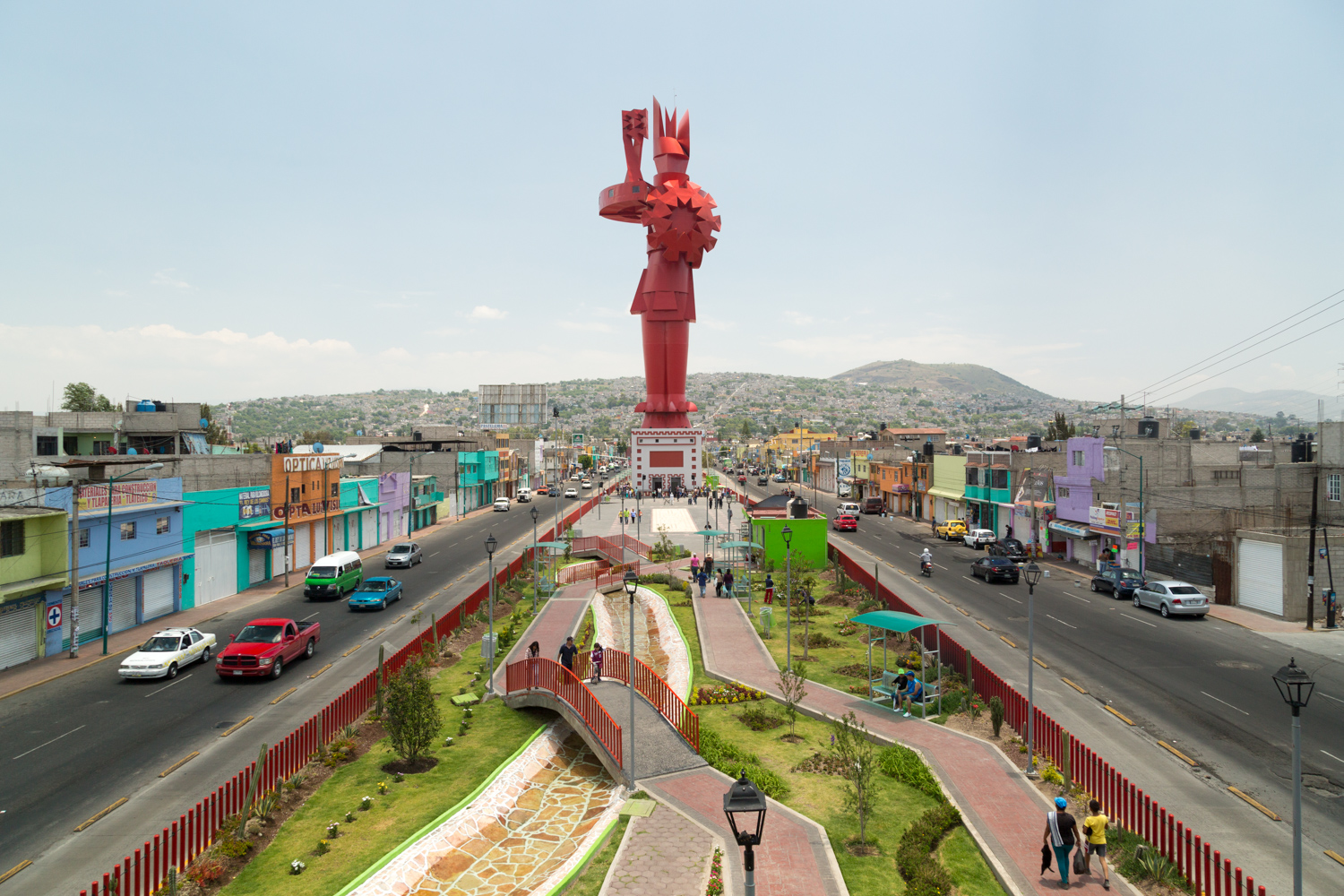
Ciudad Satélite is a district largely comprised of single-family homes, straddling the Periférico— DF’s ring road. It is one of the wealthiest sections of the municipality of Naucalpan, which sits in the hills of the Estado de México that border the District and has a population of 800,000 Master planned in the mid-1950s by a team of urban designers led by one of the most famous urban-scale architects of the era, Mario Pani, Satélite was, as its name suggests, meant to be a self-sufficient “city outside of the city.”
Pani had already been extremely active in the late forties and into the fifties. He had built the first condominium in the nation in Acapulco in 1950; designed some of the earliest Corbusier-inspired housing blocks in D.F., such as the Unidad Habitacional Miguel Alemán (1947-1948); and had guided the design of the massive university campus in the south of the city, the Ciudad Universitaria. All of this work had happened under the presidency of the pro-growth Miguel Alemán Valdés, and so when that former President and his family decided to develop some land it held in Naucalpan, Pani was an obvious choice.
Beginning around 1957, Satélite was constructed on open land near the burgeoning industrial zones of Naucalpan, and set consciously against the status quo of development. The upwardly mobile workers in these new industry parks would be able to both live and work outside the crush of people in DF. Furthermore, they would do it in a carefully designed splendor: In 1957, Pani boasted that although “cities...have grown in a disorganized and anarchic form...without the braking force to limit it...this will never happen in Ciudad Satélite... because it is a city with limits.”
Specifically, the development would be encircled with greenbelts, and their shape defined by the sweeping, organic lines of the various boulevards or circuitos that gave form to the district. With names like “Poets,” “Geographers,” “Economists,” “Novelists,” or “Heroes,” the circuitos would make up a frame upon which the simple, streamlined homes could blossom. The roadway plan for the neighborhood, these green paths that are now filled with joggers at dusk, was a mix of Garden City traditions, introduced to the project by Mexican painter Jose Luis Cuevas, and the “Herrey system,” a design of German-American provenance meant to balance the needs of automobiles and pedestrians that had already been deployed in the Ciudad Universitaria.3 Though Satélite is often simply described as a U.S.-styled suburb, its aesthetic influences were an international blend.
Filling in the 250 – 600 square meter lots lining the circuitos (and the smaller streets that ran between them) were a few thousand single-family homes. These, seemingly, were to follow the example set by Satélite’s icon, the Torres de Satélite—a monument of five board-formed concrete towers, the tallest measuring 170 meters in height, that was the iconic architect Luis Barragán’s contribution to the development. Brightly colored and prominently placed in the center of the highway that passes through Satélite, the sculpture is powerful enough in the cultural identity of Satelucos (as residents here are known) to have merited a spot in the local church’s representation of the ascension of Christ. Like the towers, the homes of the district were simple, boxy structures made of plaster, concrete, and decorative stone. They had large, sash-style windows, open plans, and were equipped with front yards for socializing and parking. Walking the neighborhood in 2015, however, gives little sense of what the streetscape must have looked like in its early years. The amount of remodeling and complete tear-downs that have occurred in the interceding time have made it necessary to look at the surviving contemporaneous documentation of the project to understand its original architecture.
Satélite, as cultural scholars Capron and de Alba point out, was sold through print, radio, and television advertisements from the time of its construction in 1957 until around 1968.5 One TV spot in particular, from the early 1960s, opens on an image of Barragán’s Torres before flipping through some of the visual tastes of the good life for thirty seconds. Here we can see the modern, unadorned lines of the domestic exteriors; the spacious, uncluttered, sun-drenched domestic life within; and the space for children to play out front— all of them images that call to mind Lewis Mumford and Pare Lorentz’s 1939 film “The City,” itself a relic of an earlier U.S. iteration of a modernist suburban dream. There are images of manicured nature (seemingly to be included in the price that remains floating on screen), large cars cruising on the open freeway, swimming pools (both indoor and out), and a bit of the public amenities: a clean, modern supermarket, and a reassuring glimpse of the Satélite security patrol. Every piece of this short film captures some aspect of the desirability of the development, and so gives a sense of what those in a certain level of housing market in that moment in the city’s development prioritized. The benefit of 50 years between the neighborhood’s inauguration and the present moment allows us to reflect upon Satélite’s effect on the imagination of suburbia across the city, and indeed the development’s own ability to live up to the lifestyle constructed in its marketing.
Ciudad Nezahualcóyotl
Ciudad Nezahualcóyotl, or Neza, is an independent municipality of the Estado de México with 1.1 million people living in extra-legally built two-or three-story cinderblock structures in the dry lakebed of the former Lake of Texcoco. The development of Neza’s vast blanket of equal sized lots—a favorite of aerial photographers hoping to capture a sense of out-of-control urbanization—is a history far from that of powerful political elites and famous Modernist architects. Nonetheless, like Satélite, Neza’s founding is a process of subdivision, homeownership, and planning—in short, of suburbanization.
Jose Castillo, an architect and scholar of urbanism in the city, has written extensively on the development of the informal districts of the city. The “urbanisms of the informal,” he argues in his 2000 doctoral dissertation on three districts in Estado de México, are more diverse, more complex, and far more organized than they are often given credit for.6 Writing on Neza, his research demonstrates that there was a sophisticated network of illegal developers who not only sold thousands of lots on the drained lakebed, but who also drew up an ordered street grid for the city.
The 36 square kilometers that make up Ciudad Neza were divided into so-called “mega-blocks,” each roughly one square kilometer and subdivided into around 90 blocks, with 50 lots of 150 square meters within. Although Castillo pegs the first settlements in the area “around 1946,” the planning and occupation of the organized began in earnest in the late 1950s.7 Plans were drawn up by a business—operating in the open with a listed address in downtown D.F.— that plotted out the thousands of parcels for homes, what are described as hierarchical streets, orthogonal blocks, large spaces (450m x 120m) within each mega-block with space for “a market, an elementary school, and a high school.”8 Space was even designated for public parking.
Though these developers had no legal claim to the land they were selling, much less a legitimate right to sell it, the plots sold quickly. By 1964, the 100,000 people living in the area successfully formed an independent municipality that, a year later, hosted schools, health centers, and over two dozen public markets. An effective, if legally unrecognized transportation system of buses and taxis had arisen to transport the commuter population of Neza into DF for work. Without a doubt, Neza’s informality had consequences: the city would lack fully functioning electricity, water, and sewage (not to mention paved streets) for decades to come. The process of formalizing land tenure would not begin until the 1970s, and last through the 1990s. But taken as a whole, families had purchased homes in a newly developed part of the metropolis from which they could commute to their jobs. A suburb was born.
In the first census in which Neza was counted, in 1970, the city had boomed to 580,436 living in 98,338 units. While the municipality’s grid and public spaces had been planned, lots were sold individually and, unlike Satélite, there were no homes to inhabit. The lots, at around 150 square meters, were far larger than the 50 or even 20 square meters that these families might have expected to attain for a similar price within D.F. While the architecture of Satélite was prescribed by its planners, in Neza the limited means of the residents was the unifying design cue. Most of them recent job-seeking immigrants to the metro area, the residents of Neza would settle temporarily in makeshift shacks at the rear of the long lots while they constructed a concrete or cinderblock row house at the front lot line. Despite the absence of anything resembling building codes or design standards, the huge agglomeration of Neza quickly arrived at a style. The gray single-family home, built without private parking, fit the needs and the abilities of the majority of residents, and, as will be seen, provided a foundation for adaptation and upward mobility.
At the municipal scale, Neza was a product of a network of pirate developers and, at the block-scale, a product of its new owners’ aspirations. The relationship between those two parties was initially one of salesmanship: there are photographs of the large, boldly painted street-side advertisements for properties on the lakebed, and Castillo records a “widespread [sales] campaign through newspaper and radio advertisements, as well as printed flyers.” The illegal (or, at best, semi-legal) developers operated in the open, with their advertisements citing an office in the center of D.F. Like the buyers at Satélite, the promise of space and ownership—in a city long beset by strife between renters and landlords— seduced the new residents of Neza. By the 1970s, however, the relationship had soured. Self-organized residents initiated a mortgage strike in the face of woefully inadequate infrastructure, and even, on several occasions, burned down the developers’ local offices. In 1973, government interests had stepped in to begin a slow process of normalization and service provision that would continue for the remainder of the century.
In 2015, Ciudad Satélite viewed from a satellite is certainly greener than Neza, but it is far from the “city apart from the city” that was originally designed. Neza’s central blocks have been filled in by schools, government buildings, and hospitals—unfortunately, almost anything but the open space that had been optimistically planned. Both urban designs have been subsumed and surrounded by the continuing process of suburbanization in the Mexico City metro area. Both were successful enough at their goals of providing suburban homes to a certain class of resident that they seeded the expansion of housing around and beyond their designated boundaries. Their respective urban plans have been modified to deal with the crush of migration and population growth in the city; on every block of both Satélite and Neza, society’s ability to remake architecture to fit its evolving needs is evident. Perhaps the only things that have persisted since the mid-fifties planning of both settlements are their respective cultural images: the debonair, upper class district and the vast, hopeless slum.
Models for Growth
In 1990, Mario Pani recalled that his team’s vision of Satélite had been compromised. Instead of undeveloped space surrounding the development, “more lots to sell, more homes, more businesses, and more apartments [meant] more money for the speculator and investor, but also more people, more cars, and less water, insufficient drainage, and terrible conditions for driving.”12 Their city had been intended to sit apart from the actual city, to repose in nature and to broker a specific relationship with it. But sprawl, motivated by the same causes as the somewhat far-sighted Satélite, and spurred into the same zone by its relatively quick success, swept into and around the district. The voracious appetite for homes substituted second-order developments like Fuentes de Satélite, and Buenavista Satélite for natural splendor. Luis Barragán, the designer of the Torres, had initially been tapped to design the neighboring zone of Lomas Verdes, but it was instead developed piecemeal, without a masterplan. This was true of all the developments that spread north from the DF—the same highway that carries commuters to Satélite continues onward, as did a new generation of unplanned upper middle class suburbs.
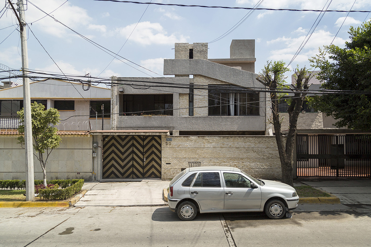
Architecturally, Satélite had changed a great deal by the time its construction was completed, and today it continues to slowly shift its form from a unitary development to that of a mature neighborhood with a host of styles. The open front yards and unguarded parking spaces of the neighborhood’s inception have given way to secured, fenced, even electrified space for cars. On most blocks, there now exists an unbroken line of defended space—a testament to either the realities of living in an unequal urban area, or the nervousness of living of a famously well-off neighborhood in a city perceived as wildly unsafe. Behind those walls, homes in Satélite have been either modified to a point of illegibility, or demolished and replaced with a panoply of architectural markers. The large lots in the area were perhaps more attractive to buyers than the understated architecture of Pani’s design. Where modernist, clean lines once proliferated, there are now mansard roofs, Italianate tiles, rounded, gleaming eighties-era glass, and even a small compound of sod-roofed domes.
Neza’s homes have been works in progress for much of that city’s twentieth century history. Concrete and cinder blocks are stacked one, two, and now often three stories. The image of rebar protruding from the top story of the neighborhood’s row houses, is often referred to as an architectural metaphor for the aspirational nature of informal development that Neza represents. But while this strategy of anticipating another floor can still be seen in the informal neighborhoods that have been developed further from DF—more recent places like Chalco or Chimalhuacán—Neza feels less and less like a developing neighborhood. Throughout the neighborhood, buildings seem purposefully topped out at two or three stories, and the rough brick or cinderblock facades have, more often than not, been plastered, painted and therefore finished.